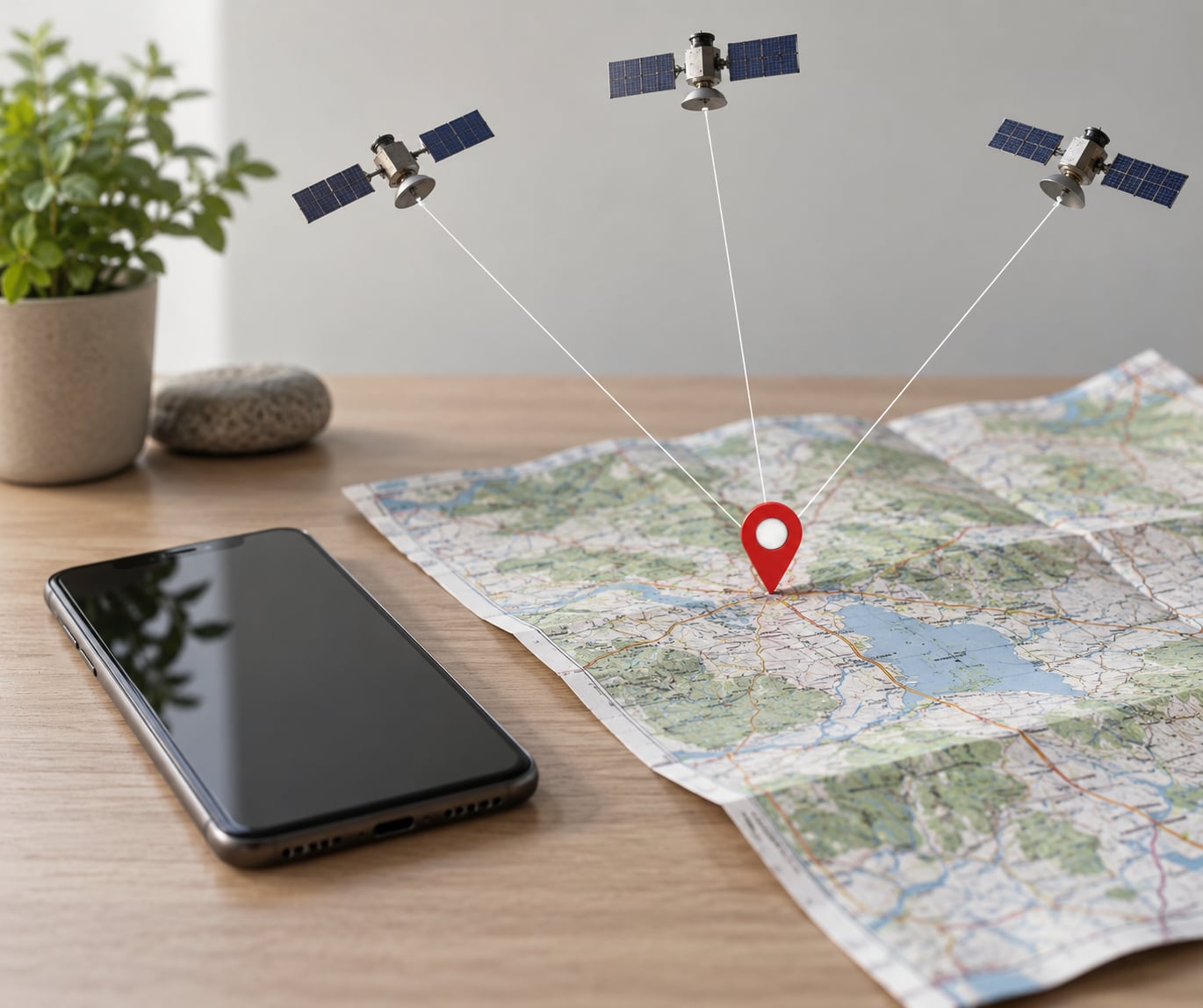
Here is the short answer: GPS works by measuring how long radio signals from at least four orbiting satellites take to reach a receiver on Earth. Your device turns each signal’s flight time into a distance, and the one point in space sitting at exactly those distances is your location.
That is genuinely all it is. No camera is watching you, no signal is sent back to the satellite, and nothing in orbit knows your name. Your phone is only listening to a steady stream of one-way radio messages that each carry two facts: where the satellite was when it sent the message, and what time that was.
The rest of this guide unpacks that mechanism step by step, explains why four satellites are involved rather than three, and covers the everyday situations where the position on your screen is quietly wrong.
Table of Contents
- What Is GPS, and What Does It Actually Do?
- Why GPS Needs at Least Four Satellites
- How Satellite Signals Carry Precise Timing Information
- How Your Device Calculates the Distance to Each Satellite
- How GPS Turns Satellite Distances into a Location
- How GPS actually knows where you are, in four steps
- Why Your Phone’s Clock Does Not Have to Be an Atomic Clock
- Why Satellite Data Does Not Give You Turn-by-Turn Directions
- What Makes a GPS Position Inaccurate?
- How Accurate Is GPS, and How Does That Change in Practice?
- How Does GPS Work Indoors, in Tunnels, and in Cities?
- What Is the Difference Between GPS, GNSS, and Location Services?
- Frequently Asked Questions
- Does GPS work without mobile data or internet?
- Why does my phone show the wrong location?
- How many GPS satellites does a phone need for an accurate fix?
- Can GPS determine my exact home address?
- Why does GPS take longer to get a location after turning on?
- Do GPS and GPS location services use the same thing?
- What to Remember First
What Is GPS, and What Does It Actually Do?
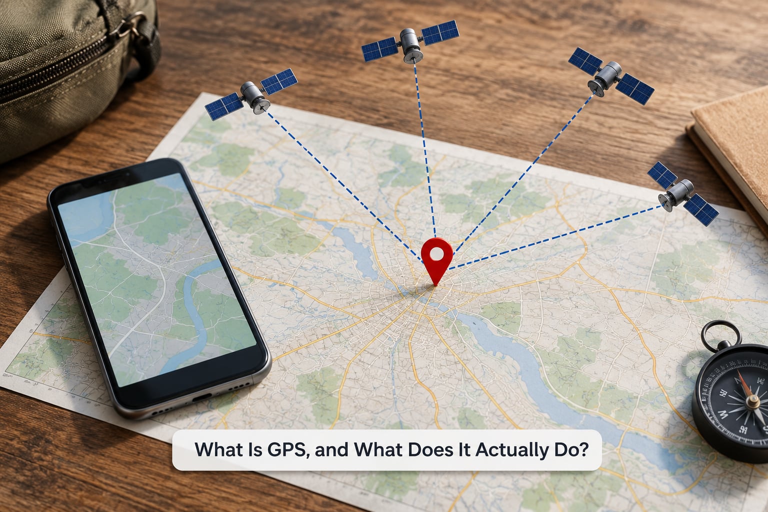
GPS is a positioning system, not a map service. That distinction matters, because people often assume the satellites somehow store the road network. They do not. They store nothing but their own position and the time.
The Global Positioning System began as a military navigation project in the United States and opened to civilian use in the 1980s, decades after the first non-military receivers had already used it for surveying and mapping. Selective availability, which deliberately degraded civilian accuracy, was switched off in 2000, and that single decision is the reason a phone in your pocket now gets a position good to a few metres.
The orbiting segment is a fleet of roughly 30 satellites, each circling the Earth about 20,000 kilometres up and finishing one orbit every 12 hours. There are ground stations on Earth that watch each satellite, measure where it actually ended up, and upload corrected orbit and clock information back to it. Your phone is the third part of the system, and it is entirely passive.
Why GPS Needs at Least Four Satellites
One satellite tells you how far away you are, but nothing about which direction. Two satellites narrow you to a circle. A third cuts that circle down to a line or to two candidate points. The fourth is what turns those candidates into a single reliable answer, and most explainers skip the reason why.
The reason is clocks. Your phone can count the arrival of a signal accurately, but its own timekeeping is based on a cheap quartz crystal that is wrong by a small, unknown amount. Every distance your device calculates inherits that error. A fourth measurement gives the receiver an extra unknown to solve for, and that unknown is its own clock offset.
Fix that offset and it can be subtracted from every other measurement at once. That is the real reason four satellites are needed, not some arbitrary rule about geometry.
How Satellite Signals Carry Precise Timing Information
Each satellite continuously broadcasts a repeating signal containing the time it was sent and its own position at that moment. Alongside that, every satellite transmits ephemeris data, a small block of parameters describing its orbit, and an almanac, a coarser version of the same information for the whole constellation.
The satellite’s own position is known to the control segment, not to your phone. Ground stations monitor each spacecraft, watch for drift in its orbit, and measure any error in its clock. The corrected figures are uploaded back up, and the satellite rebroadcasts them, so the numbers arriving at your handset are already sharpened by ground control.
Timing matters as much as position here. Light crosses about 30 centimetres in a billionth of a second, so a receiver that is even slightly sloppy about when a message arrived turns that sloppiness directly into tens of metres of position error. Satellites carry atomic clocks to hold time accurately enough that this does not happen, and the system also compensates for the fact that clocks run measurably faster in orbit than on the ground.
There is no photograph in the signal and no identification tag. The message is anonymous, encrypted against spoofing, and readable by anyone who can see the sky.
How Your Device Calculates the Distance to Each Satellite
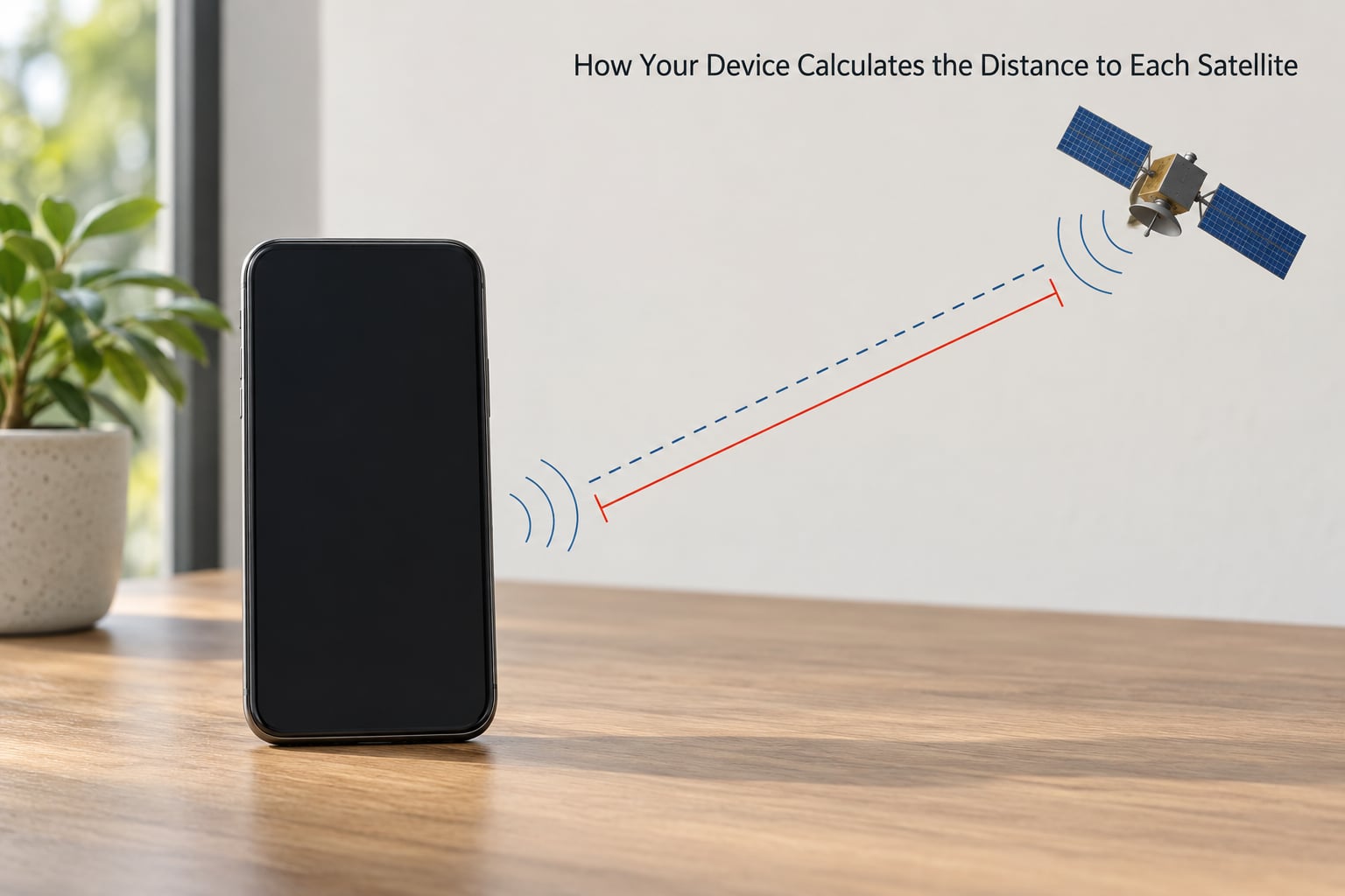
Your receiver measures time, not distance. It records the instant a signal arrives, subtracts the moment the satellite says it left, and multiplies that flight time by the speed of light. Distance is the result of that calculation, never something measured directly.
A radio signal covers roughly 300,000 kilometres in a second, so the arithmetic is simple once you have the timing. A satellite about 20,000 kilometres up that is close to overhead produces a flight time near 67 milliseconds, and that works out to about 20,000 kilometres. Push the satellite toward the horizon and the distance grows, because the straight line through the atmosphere gets longer.
Receivers typically work with code-based measurements, where the arrival time comes from comparing the satellite’s repeating code against an identical copy running on the receiver. That yields something called pseudorange: a distance that still contains the receiver’s clock error. The fourth satellite is what lets the device split that error back out.
How GPS Turns Satellite Distances into a Location
Distances are enough on their own, with no angles anywhere. Each distance from a satellite describes a sphere centred on that satellite, and your position is the single point lying on all of those spheres at once.
How GPS actually knows where you are, in four steps
Start with one satellite and its measured distance. You could be anywhere on the surface of a sphere around it, which is millions of possible places. Add a second satellite and the two spheres intersect in a circle, cutting the possibilities down to a line of them.
A third sphere meets that circle at two points in principle, one of which is usually discarded as physically implausible. In the flat 2D maps most explainers draw, three circles meeting at a single point looks like the end of the story.
Real life is three-dimensional, and that is where the diagram and the satellite system part ways. Positions on Earth carry latitude, longitude, and altitude, so each distance defines a sphere rather than a circle. Solving for latitude, longitude, and altitude plus the receiver’s clock error takes four unknowns, which means four satellites in normal conditions.
Two satellites already give you a circle, three give you a line, and a fourth completes the set. This process is called trilateration, and the distinction from triangulation is not pedantry. Triangulation works from measured angles between known points, while trilateration works purely from measured distances, which is what a timed signal actually provides.
Why Your Phone’s Clock Does Not Have to Be an Atomic Clock
The clock problem has a neat solution, and it is the reason a two-dollar phone can produce a position good enough to find a cafe door. Your receiver does not need to know the time accurately. It only needs to know how wrong its clock is, and the satellites can tell it.
Because every satellite timestamp is broadcast against a shared reference, the receiver can compare its own clock reading against each of them. With enough simultaneous measurements, the discrepancy it sees across four satellites is the receiver’s own error. The receiver treats that as a fourth distance to solve for, subtracts it from every pseudorange, and is left with four clean ranges and a genuine three-dimensional position.
This is also why satellite clocks have to be so disciplined. An onboard clock error becomes a distance error, and a nanosecond of drift maps to roughly 30 centimetres of position shift. In practice the satellites carry rubidium and caesium atomic clocks and the control segment keeps nudging them back on time.
Why Satellite Data Does Not Give You Turn-by-Turn Directions
GPS hands you a coordinate pair and an altitude. It knows nothing about roads, buildings, rivers, or the bridge that closed last winter. Turn-by-turn directions are the work of a mapping company, not of the satellite system.
Once your device has its coordinate, the map on screen compares it against a stored model of the world and drops a pin on the nearest matching feature, usually the side of the street you are standing on. Routing is a separate calculation over that same road network, weighing the number of lanes, speed limits, traffic and turn restrictions to pick the fastest path.
Where does the road data come from? Not from the satellites. Map makers combine aerial imagery, street-level photography, GPS traces collected from millions of journeys, and field surveys. New roads show up in the map when somebody drives them and the resulting traces are checked by human editors, which is why a genuinely new road can take weeks or months to appear in a navigation app.
GPS can also be genuinely wrong by a few hundred metres while your road data is flawless, and the two failures look completely different on screen. A street with no data shows an empty grey line. A coordinate error shows you confidently standing in a car park that is not there.
What Makes a GPS Position Inaccurate?
Can GPS give a wrong location? Regularly, and for reasons that mostly have nothing to do with broken satellites.
The biggest everyday cause is multipath error. Radio signals bounce off buildings, metal, water and glass before reaching you, and the receiver may lock onto the reflection instead of the direct path. The reflected journey is longer, so the calculated distance is longer, so the pin drifts toward whichever side of the street has the glassiest facade.
A street with tall buildings on both sides produces this so reliably that it has a nickname, the urban canyon. Signals are cut off or reflected at angles that make satellite geometry poor, and accuracy falls off sharply. The same effect inside a stadium or a parking garage is why a phone on a dashboard can still show a position with a blue dot that keeps drifting.
Satellite and signal delay are the other two standard categories. The signal slows slightly passing through the ionosphere and troposphere on its way down, which is corrected for using models broadcast alongside the navigation message. Satellite position and clock errors are handled by the control segment’s tracking and corrections.
On top of those sit environmental and device issues. Signals weaken near hills, inside vehicles, under dense tree cover, or in a bad phone case, and the antenna’s position in the handset decides how well it hears anything at all. Deliberate interference, called jamming, and fake signals, called spoofing, are real but uncommon outside of specialist equipment.
How Accurate Is GPS, and How Does That Change in Practice?
Open-sky consumer accuracy is usually quoted as 3 to 5 metres, and that is a realistic expectation rather than a guarantee. In practice the number you see on screen is an estimated error radius, and it grows quickly once buildings get involved.
| Situation | Typical accuracy | What drives it |
|---|---|---|
| Open sky, good weather | 3 to 5 metres | Clear view of several satellites, normal satellite geometry |
| Assisted startup indoors | 5 to 30 metres | Network assistance supplies a starting guess, then satellites refine it |
| Urban canyon | 10 to 50 metres or worse | Reflected and blocked signals, poor satellite angles |
| Deep indoors or underground | Often no satellite fix at all | Too few signals reach the antenna; the device uses Wi-Fi, cell data or sensors |
| Surveying and agriculture equipment | Centimetre level | Carrier-phase measurements plus correction services |
Two numbers get confused constantly. Accuracy is how close the estimate is to the truth; update frequency is how often the estimate is recomputed, usually once per second in a phone. A device can be perfectly accurate and updating slowly, or updating constantly and jumping around.
How Does GPS Work Indoors, in Tunnels, and in Cities?
Indoors, in a tunnel or in a dense city centre, a phone often shows a position anyway, and that is the part of the satellite story people find hardest to believe. The honest explanation is that the phone is mostly not using satellites at all by then.
Where satellite reception is weak or absent, phones fall back on a stack of other sources. Nearby Wi-Fi networks give an approximate position from a database of where access points sit. Cell tower triangulation estimates distance to several masts. Motion sensors carry the last known position forward for a moment. The previous fix is held for a short time instead of jumping to nothing.
Assisted GPS, usually called A-GPS, is the shortcut that makes a phone lock almost instantly. Instead of hunting blindly for satellites, it downloads an approximate position and the satellite schedule over the mobile network first, so the receiver starts already pointing at the right part of the sky. A cold receiver with no such help can take up to a minute.
Map matching is the last step. Your raw position is an error radius, often tens of metres across, and the nearest point on a known road is treated as the likely real position. It works well on a motorway and badly in a car park, where your nearest road may genuinely be somewhere you have never been.
What Is the Difference Between GPS, GNSS, and Location Services?
GPS is one specific satellite navigation system, owned and operated by the United States government. GNSS is the umbrella term for all of them, and GNSS is what your phone’s setting usually reads. Location services is the software layer that combines positioning with maps, sensors, network data and routing.
Several countries operate their own constellations, and most phones use more than one at a time, which is why accuracy often improves in open country compared with a single system.
| System | Owning authority | Nominal constellation | Typical civil accuracy |
|---|---|---|---|
| GPS | United States | Around 30 satellites | 3 to 5 metres |
| GLONASS | Russia | Around 24 satellites | 3 to 5 metres |
| Galileo | European Union | Around 30 satellites | Under 1 metre |
| BeiDou | China | Around 40 satellites | 1 to 2 metres |
Worth correcting one myth while we are here: GPS is not a tracking system. Satellites transmit, they never receive, and they cannot tell who is listening. Whoever carries the receiver decides what happens to the position, which is why a phone with location disabled gets no location from the sky at all.
Frequently Asked Questions
Does GPS work without mobile data or internet?
Yes. GPS reception is entirely passive, so a receiver can get a position in the middle of nowhere with no connection at all. What needs a connection is the map data, the route calculation and any assisted startup, which is why your phone can still tell you exactly where you are while failing to load a map of that spot.
Why does my phone show the wrong location?
Usually reflections and obstructions. Radio signals bounce off buildings and metal, and the receiver sometimes locks onto the longer reflected path instead of the direct one, which drags your position sideways. Being indoors, in a tunnel, under dense trees or in a poor urban street layout makes it worse. Last known position, Wi-Fi and cell data are usually filling the gap.
How many GPS satellites does a phone need for an accurate fix?
Four at minimum for a full three-dimensional fix, because four unknowns have to be solved: latitude, longitude, altitude and the receiver’s own clock error. Three satellites give a two-dimensional position with an estimated altitude, which is enough for flat open terrain. In open sky a phone will typically lock onto eight or more, so poor satellite geometry, not a shortage, is the usual cause of slow fixes.
Can GPS determine my exact home address?
No. It returns a latitude and longitude accurate to a few metres under open sky, which is a point, not an address. Working out a street or house number requires map data, which your phone compares against a stored model of buildings and roads. That is also why GPS can place you confidently in the wrong country if the coordinates are wrong, while the address lookup would catch it.
Why does GPS take longer to get a location after turning on?
A receiver starting from scratch does not know where in the sky to look, so it has to search for satellite signals one by one before it has enough to calculate anything. This cold start can take up to a minute. If the phone recently downloaded an approximate position and satellite schedule from the mobile network, it starts already aimed correctly and usually locks within a second or two.
Do GPS and GPS location services use the same thing?
Location services are the layer built on top of positioning. GPS supplies a coordinate, while location services combine that coordinate with map data, Wi-Fi and cell positioning, motion sensors and routing software to produce a pin on a map and a set of directions. Turning location services off in your settings disables that whole layer, including the GPS receiver underneath it.
What to Remember First
Satellites transmit their position and the exact time each message left. Your receiver measures when each message arrived, converts that flight time into a distance, and finds the single point matching several of those distances at once. Map data then turns that point into a pin and a route.
Four measurements rather than three because your phone’s cheap quartz clock is wrong by an unknown amount, and the extra measurement works out by how wrong. Keep those two ideas in place and the rest of the detail slots in behind them.